MapInfo Symbols Support
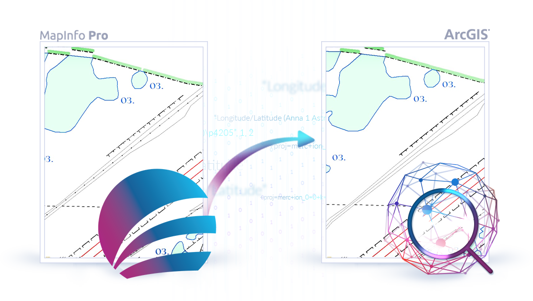
Complex symbols used to display features in the map may be a major issue when converting data from one format to another,
however, TAB Reader tools allow to solve it.
TAB Reader preserves all original MapInfo rendering and symbology properties, while both direct reading TAB files
in ArcGIS Pro and importing data. Symbols obtained from TAB files are saved in geodatabase or LYRX file.
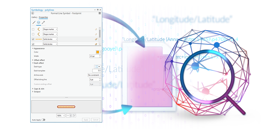
Retention of Original Rendering and Symbology Properties
MapInfo uses a lot of symbols to display features in the map, and the most complex ones are various lines.
TAB Reader extracts symbols styles from MapInfo libraries and creates corresponding symbols in ArcGIS. MapInfo symbols for points and polygons are also successfully converted and most accurately displayed in ArcGIS Pro.
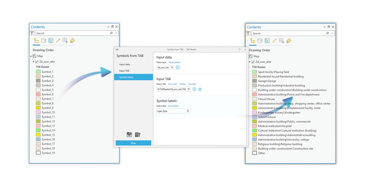
Loading TAB Symbols
Feature classes obtained during import are shown in accordance with MapInfo styles and symbols libraries for lines, rasters and fonts. However, in case if wrong MapInfo library has been used, TAB Reader allows to easily change symbols display without the need to import them once again.
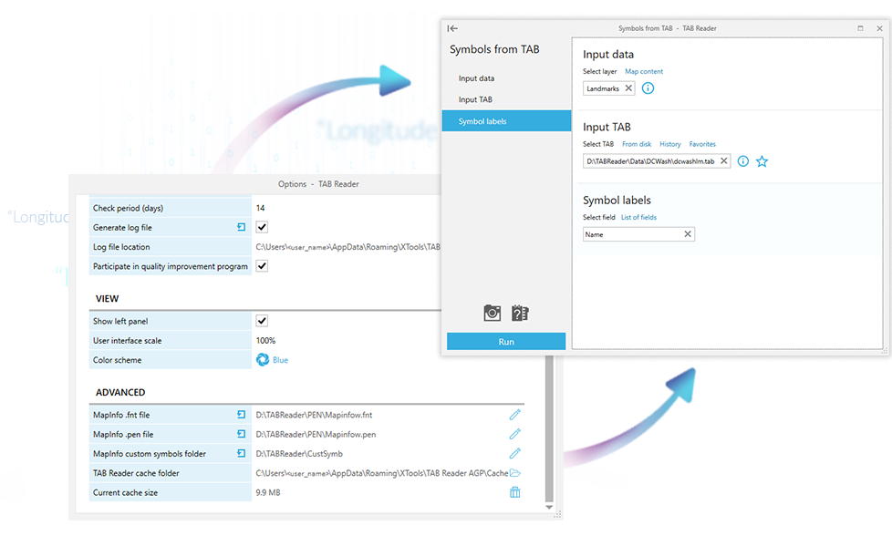
Named Symbol Classes
ArcGIS Pro allows to set names for symbol classes with specific symbols in table of content, whereas MapInfo does not provide such option.
TAB Reader enables naming symbol classes using default values or expression written using fields in attribute table of TAB file. Thus, names of symbol classes become meaningful.
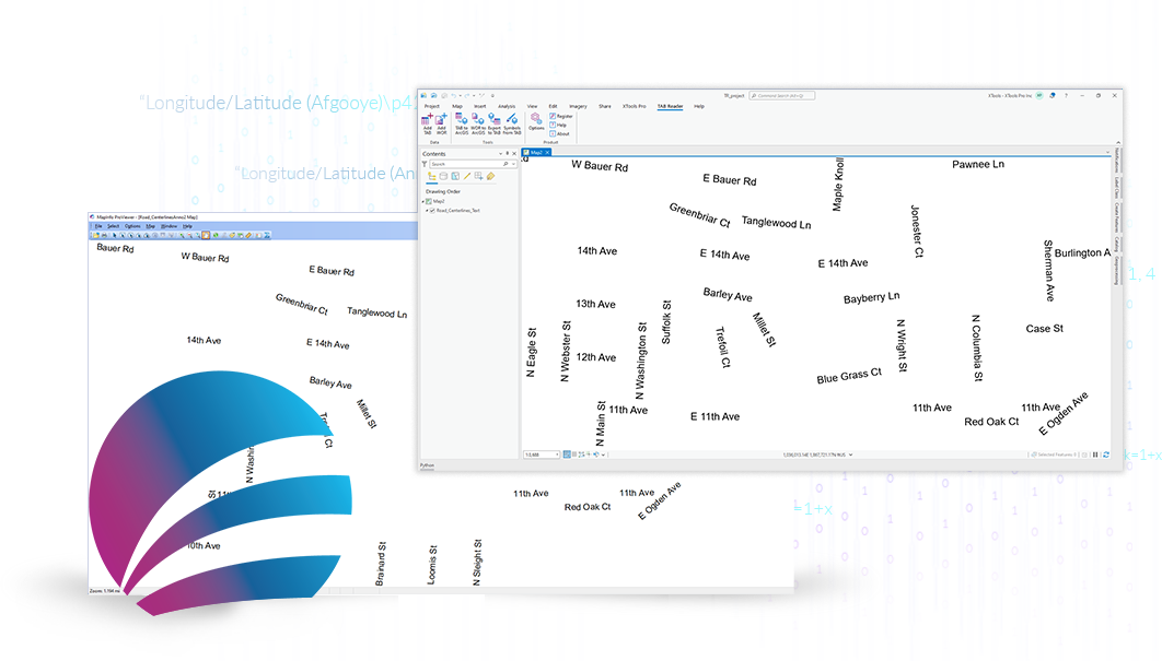
Saving Texts as ArcGIS Annotation Feature Classes
Text features are often used when preparing maps in MapInfo, therefore it is important to preserve their native parameters when transferring them to ArcGIS Pro.
TAB Reader saves all text features containing in TAB files as ArcGIS Pro annotation feature classes, most accurately transferring style, size and rotation angle of the original texts.
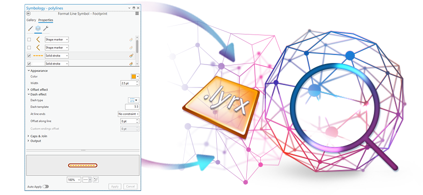
Saving Symbols in LYRX Files
TAB Reader allows to save symbols obtained after importing as LYRX files.
Saving symbols in ArcGIS Pro project
Symbols, lines and filling styles can be saved in ArcGIS Pro project after import or adding data to the map.