Working with MapInfo Data in ArcGIS
TAB Reader allows working with MapInfo data directly in ArcGIS Pro. At that, TAB Reader supports simple geometry, spatial indexes and attributes. MapInfo spatial reference is also recognized which allows to complement existing ArcGIS Pro maps with MapInfo data in TAB format.
Direct Reading of MapInfo Data
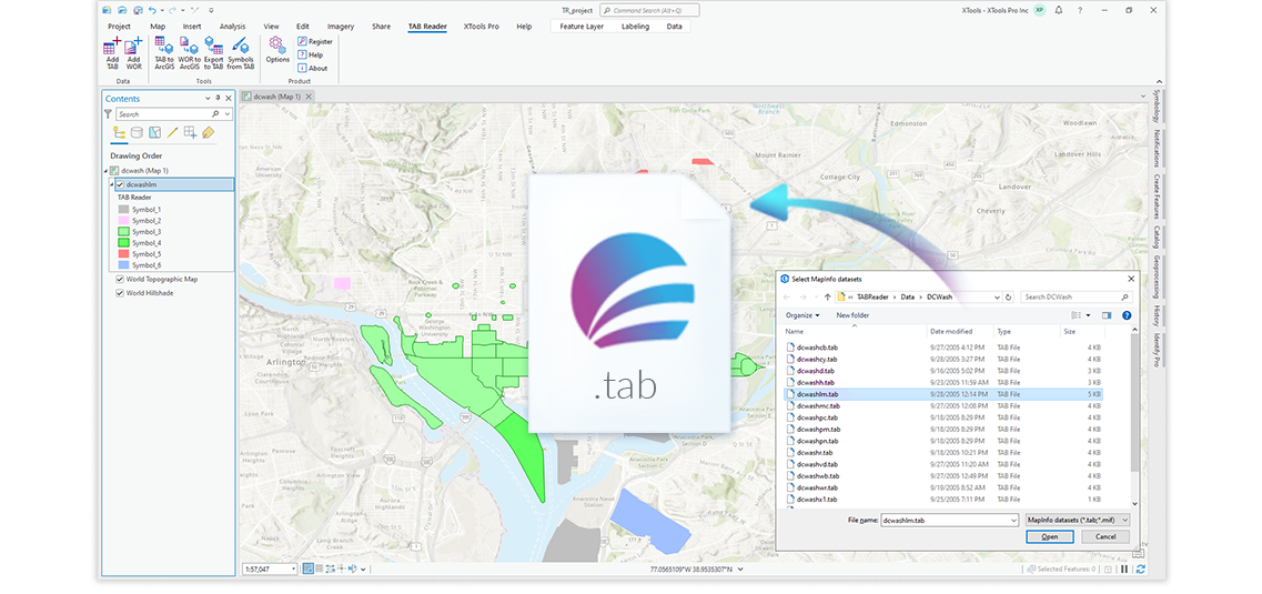
TAB Reader functionality for direct reading of MapInfo data allows to immediately start working with it in ArcGIS Pro – just add necessary TAB or WOR files to ArcGIS Pro.
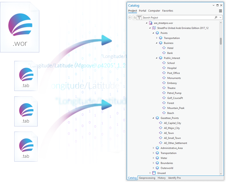
Working with MapInfo Workspaces in Catalog
TAB Reader allows to conveniently work with MapInfo workspaces in ArcGIS Pro. These files can be accessed in Catalog same as ArcGIS files and geodatabases. Besides, workspaces allow to open groups of TAB files in ArcGIS Pro as they were organized in MapInfo.
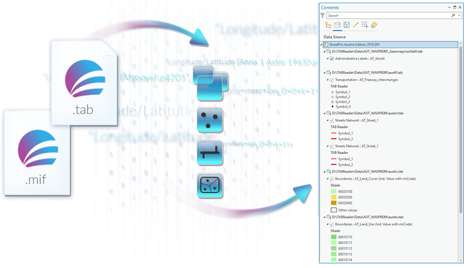
Simple Shapes Support
TAB Reader allows to easily transfer data with simple geometry (points, lines and polygons) from TAB and MIF/MID files to ArcGIS Pro.
Coordinate System Support
Difference of coordinate systems description in MapInfo and ArcGIS may cause problems when combining data in these two different formats.
TAB Reader recognizes and completely preserves native information about coordinate system of TAB files, and so allows to correctly combine MapInfo and ArcGIS data.

Attribute Data Support
TAB Reader allows to directly read and transfer MapInfo attribute data to ArcGIS Pro with no loss.

Text Data Support
TAB Reader recognizes MapInfo text data and converts it to ArcGIS supported formats. At that, while direct reading labels and texts are transformed to Labels, whereas converted text objects are transformed to annotations.

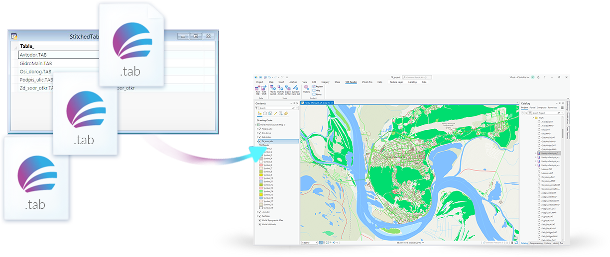
Seamless Tables Support
A specific type of TAB files in MapInfo called seamless tables allows working with a group of TAB files as with a single layer. TAB Reader recognizes such seamless tables and opens all related TAB files.
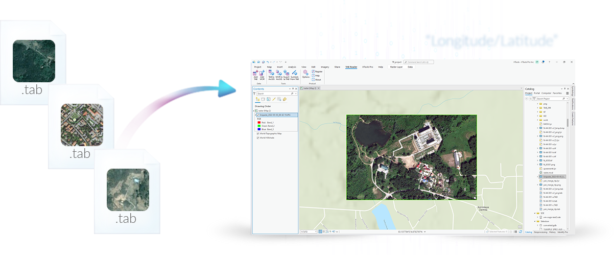
Support for TAB Files with Raster Data
Raster data in MapInfo have specific georeference type based on reference points. TAB Reader supports such georeference in TAB format which allows working with TAB rasters in ArcGIS Pro as well.